Chapter 25 · Part 05
Who Drew the Countries We Have Today?
Decolonisation, inherited borders and new states.
The end of the colonial empires produced much of today's map. India, Africa, the Middle East and the Non-Aligned Movement reveal how difficult it is to build new states upon inherited territories and institutions.
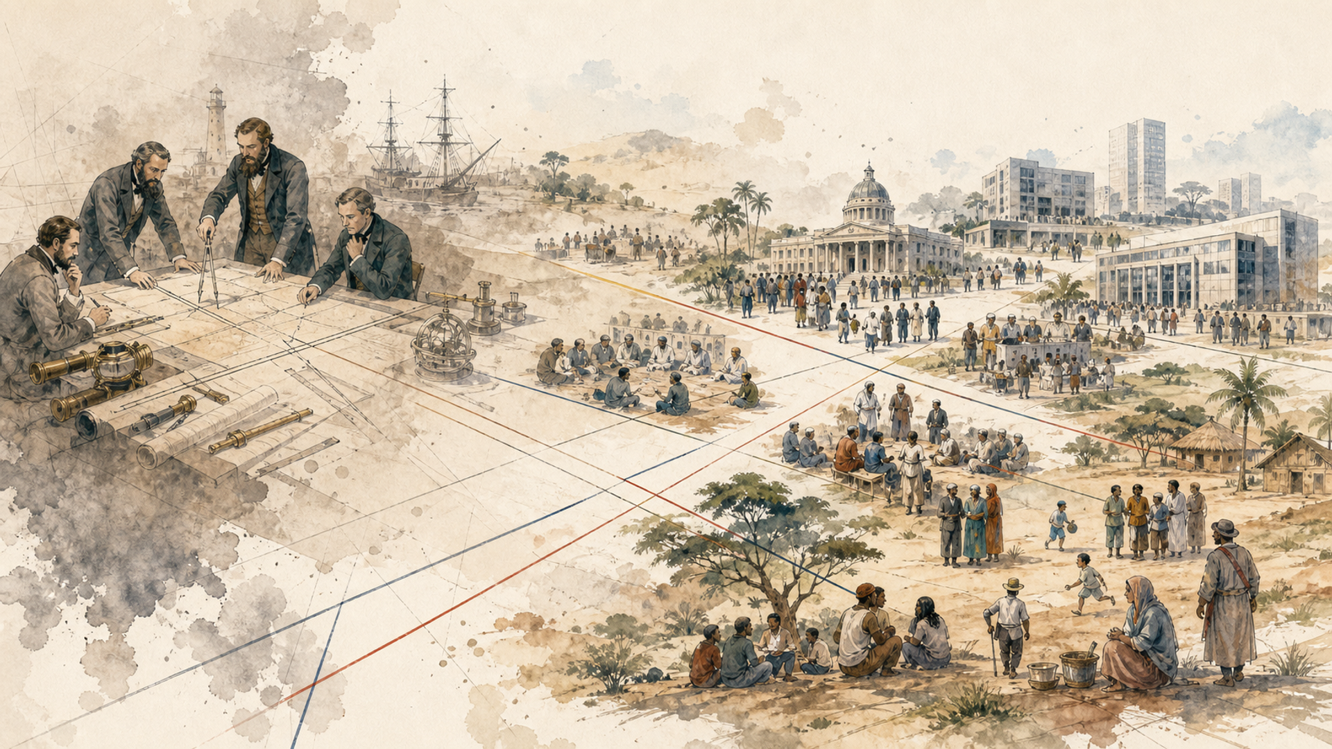
In 1945, when the United Nations was founded, some 750 million people—nearly a third of the world’s population at the time—still lived in non-self-governing territories dependent on colonial powers. If you looked at a political map from that year, you would see vast areas of Africa and Asia administered from European capitals thousands of kilometres away. Twenty years later, the map would be almost unrecognisable. The word we use for this process is decolonisation, but it can be misleading because it sounds like something that simply “happens” to empires: one day they possess colonies; then they decide to let them go. In reality, independence was almost everywhere the result of pressure, nationalist movements, wars, negotiations, economic crises, changes in public opinion and new international conditions. Some transitions were relatively peaceful; others were extraordinarily bloody. Above all, independence did not automatically solve the hardest problem: how do you turn a colonial territory into a functioning state that its inhabitants recognise as their own? Much of today’s map emerged during these decades.
India: freedom accompanied by a new frontier
British India lay at the heart of one of the world’s most important colonial empires. The independence movement had many strands, but its best-known figure is Mohandas Gandhi, who turned non-violence and civil disobedience into instruments of mass politics. Alongside him, Jawaharlal Nehru, the Indian National Congress, Muhammad Ali Jinnah and the Muslim League represented different visions of the future. When British rule ended in 1947, it did not produce a single state. India and Pakistan were created, with Pakistan initially consisting of two territories separated by more than a thousand kilometres of Indian territory: West Pakistan and East Pakistan. The division—Partition—sought to address tensions between political projects and religious communities, but a line on a map cannot neatly separate people who have lived intermingled for generations.
Millions of Hindus, Muslims and Sikhs crossed the new borders in opposite directions. The mass migration was accompanied by appalling violence and a death toll that historians estimate differently. For many families, independence—celebrated as liberation from colonialism—also meant the loss of home, fear and bereavement. It is a harsh lesson: self-determination can create a state while simultaneously creating new minorities. If the principle is that “every people should have its own country”, you must then answer an almost impossible question: precisely where does one people end and another begin, especially when they live in the same towns and villages?
East Pakistan would itself become Bangladesh in 1971 after war, repression and Indian intervention. A frontier conceived in 1947 did not close the story; it opened another chapter. In Indonesia, Sukarno proclaimed independence from the Netherlands in 1945, but the Dutch tried to re-establish control, and years of war and negotiation followed before they recognised Indonesian sovereignty in 1949. In Indochina, the end of the French empire came through a war that culminated in the French defeat at Dien Bien Phu in 1954, followed by the division of Vietnam and an even larger conflict. In Algeria, the war of independence against France, which began in 1954, was brutal and politically traumatic for French society as well; independence came in 1962.
In Ghana, by contrast, the process led by Kwame Nkrumah followed a different course and brought independence in 1957. Ghana became the first colonised country in sub-Saharan Africa to gain independence in the post-war period, and acquired enormous symbolic importance for pan-Africanism. Why did these paths differ so greatly? Because “colonialism” was not a single, identical system everywhere. The number of European settlers, local institutions, economic resources, the strength of nationalist movements, the colonial power’s strategy and the Cold War context all varied. Even the same power might negotiate in one territory and fight desperately in another.
Congo: independence without time to build the state
The Belgian Congo gained independence in June 1960. Its new prime minister, Patrice Lumumba, inherited an enormous country whose institutions had, until very recently, been controlled largely by Belgians, and in which the colonial system had prepared very few Congolese people for the highest levels of government. Within days, the army mutinied, Belgium intervened, the wealthy province of Katanga attempted to secede and the Cold War superpowers began to view the crisis as another square on the global chessboard. Lumumba was overthrown and then killed in 1961. The Congo Crisis demonstrated, with almost cruel clarity, that a new flag does not instantly create a stable state apparatus. If an administration has been designed for decades to answer to a colonial capital, independence requires the chains of command, the army, public finances, relations among regions and political legitimacy to be remade almost simultaneously. All the while, other countries are deciding whether to help you, obstruct you or turn your crisis into an element of their own strategy.
Many African borders inherited from colonial rule divided communities or brought groups with different histories together within a single state. Once independence had been achieved, why not erase them and begin again? Because beginning again also means deciding who owns every town, river, mine and road. If fifty new states simultaneously reopen the question of every frontier, the risk of cascading wars becomes enormous. In 1964, the Organisation of African Unity adopted the principle of respecting the borders that existed when states achieved independence. It was a pragmatic choice: those borders might be imperfect, but at least they provided a recognisable starting point. This principle, often associated with the logic of uti possidetis, is one reason so many colonial boundaries survived—not because the new states necessarily considered them just or natural, but because changing them could appear even more dangerous.
Here we must avoid a very popular shortcut: “Africa has problems because its borders were badly drawn.” Borders matter, but on their own they do not explain the quality of institutions, civil wars, economic growth or stability. Countries with equally artificial frontiers can follow completely different trajectories. Colonial history weighs heavily, but it does not erase everything that happens afterwards. The end of the Ottoman Empire after the First World War had already created mandates and new political entities under British and French influence. After the Second World War, decolonisation and the establishment of Israel in 1948 transformed the region further.
Israeli–Palestinian history is too complex to be reduced to a single origin, and it cannot be dismissed with the phrase “the British drew the borders badly”. Modern Zionism, Jewish immigration, European antisemitism and the Holocaust, Arab and Palestinian nationalism, the British Mandate, the 1947 UN partition plan, the proclamation of the State of Israel, the 1948 war and the displacement of hundreds of thousands of Palestinians—the Nakba—are all fundamental elements. Later wars and occupations would add further layers. For the thread of our argument, the important point is that a modern frontier can bring memory, security, identity, law and territory together in concentrated form. Looking only at physical geography is not enough; looking only at an ancient religious text is not enough; looking only at a colonial decision is not enough. The world’s most difficult regions are often precisely those in which several true explanations overlap.
New states enter a world already organised
There is another difficulty. Independent countries are not born into an empty space. They emerge during the Cold War, within an international financial system that already exists, amid global markets and often with colonial economies specialised in exporting only a handful of raw materials. A new government may formally control its own territory yet remain dependent on the world price of cocoa, copper or oil; it may have a flag and a currency but still need technology, credit or weapons from external powers. This is why many leaders began to speak not only of political independence but also of economic independence.
The Non-Aligned Movement grew in part from this desire: not simply to replace London or Paris with Washington or Moscow. In practice, however, maintaining autonomy was difficult. Aid, loans, arms sales and diplomatic support created new dependencies. Pause for a moment in front of a globe. India and Pakistan have existed as independent states for less than a century. Most African states gained independence within the lifetimes of the grandparents of many people alive today. Bangladesh was born in 1971. The former Soviet republics became independent in 1991. Yugoslavia dissolved during the 1990s and beyond, producing new states and bloody wars. Timor-Leste became independent in 2002; South Sudan in 2011. Political maps look immovable only because we print them on paper.
This prepares us for the next leap. While new states are being born, the economic world begins to connect with unprecedented intensity. Container ships, oil, international production chains and finance transform sovereignty: you can be independent and at the same time depend on components made in five countries, energy carried through a strait and capital that moves in seconds. We have spent many chapters watching states conquer territory. Now we must understand why, in the modern world, you can be vulnerable without losing a single centimetre of land.
Algeria: when a colony is considered part of the mother country
Algeria made French decolonisation particularly complicated because it was not treated merely as a distant colony: parts of its territory were organised as French departments, and it was home to a large European population, the pieds-noirs. For many French people, therefore, the idea of “leaving Algeria” did not seem equivalent to withdrawing from an overseas possession. The war that began in 1954 involved guerrilla warfare by the National Liberation Front, French repression, torture, terrorism and violence against civilians. The crisis contributed to the fall of the French Fourth Republic and Charles de Gaulle’s return to power. Algeria gained independence in 1962, and hundreds of thousands of Europeans left the country, alongside many Algerians who had fought or collaborated with France and feared reprisals. Decolonisation can therefore transform the political system of the colonial power as well as that of the colony.
In Kenya, the Mau Mau uprising of the 1950s arose amid conflicts over land, labour, representation and colonial rule. The British authorities declared a state of emergency and carried out a campaign of repression that included mass detention and grave abuses. Independence came in 1963. The case is useful because it shows how the distribution of land can remain central even when political language speaks of nationalism. A state’s frontier does not tell you who owns the best farms within it. Many independent states would therefore inherit not only borders, but also structures of ownership and inequalities produced or consolidated under colonial rule.
Independence changes the vote at the United Nations
Dozens of new states joined the UN and transformed the organisation’s political composition. Questions such as colonialism, development, racism and control over resources acquired a different weight in the General Assembly. The “Third World”, a term coined in a specific context and later used in often imprecise ways, is not simply a poor region: it is also a group of countries seeking to build collective influence in a system dominated by old and new powers. Decolonisation therefore changed not only the map, but also the institutions created in 1945. When the holders of statehood and a vote change, so do the kinds of question that move to the centre of international debate.
This is not an exclusively postcolonial problem. Belgium, Switzerland, the United Kingdom, Spain, Canada and many other states contain multiple linguistic or national identities. The difference is that some systems have had more time, resources or institutions with which to manage pluralism without dissolving. So, when we look at a state born from decolonisation, the useful question is not “is its border artificial?”—almost all political borders are artificial in the sense that they are products of human decisions. The question is: what institutions allow different groups to regard living within the same state as acceptable? That question will accompany us far beyond the colonial era.
Some empires negotiated their departure; others fought
Decolonisation did not follow a single path. Kwame Nkrumah’s Ghana gained independence from Britain in 1957 and became a symbol of pan-Africanism. Algeria won independence from France in 1962 after a particularly brutal war that had begun in 1954, in which the FLN fought French forces and civilians suffered heavily. Indonesia proclaimed independence in 1945 but had to fight and negotiate until Dutch recognition in 1949. Portugal’s colonies in Africa achieved independence in the 1970s after protracted wars and the Carnation Revolution in Portugal. These differences have consequences. A negotiated independence may leave institutions relatively intact, but also leave powerful dependencies; a war of liberation may produce a dominant armed movement and institutions shaped by conflict. In either case, the new government has to build legitimacy within borders that do not necessarily correspond to a single political identity.
At first glance, it might seem obvious that African states would redraw Europe’s borders after independence. In reality, African leaders understood the danger of opening hundreds of territorial disputes simultaneously. In 1964, the Organisation of African Unity adopted the principle of respecting the borders that existed when states achieved independence, a pragmatic choice that helped prevent a wholesale revision of the map. This does not mean that the borders caused no problems, or that all were arbitrary in the same way. It means that an inherited line can become more stable precisely because no one sees a peaceful alternative. Over time, states born within colonial borders have built genuine national identities, even where communities straddle frontiers. Calling a country “artificial” because its origins are recent is not very useful: almost all modern states are historical constructions.
In some cases, borders changed nonetheless: Eritrea and Ethiopia, Sudan and South Sudan, and the separation of East Pakistan, which became Bangladesh in 1971. These cases show that territorial integrity and self-determination can come into conflict, and international law does not always offer a politically simple answer.
The Cold War immediately enters the new states
The contemporary map, then, emerged from an accumulation of layers: ancient kingdoms and communities, imperial conquests, colonial borders, world wars, independence struggles and the decisions of new states to retain or alter what they had inherited. If you look for a single “cartographer”, you will not find one. You will find generations of people who kept drawing over earlier lines.