Chapter 08 · Part 02
How Far Can You Really Command?
Distance, communication and the limits of power.
Conquest is not government. Roads, messengers, horses and administrative networks show how the speed of information helps determine the possible scale of a state.
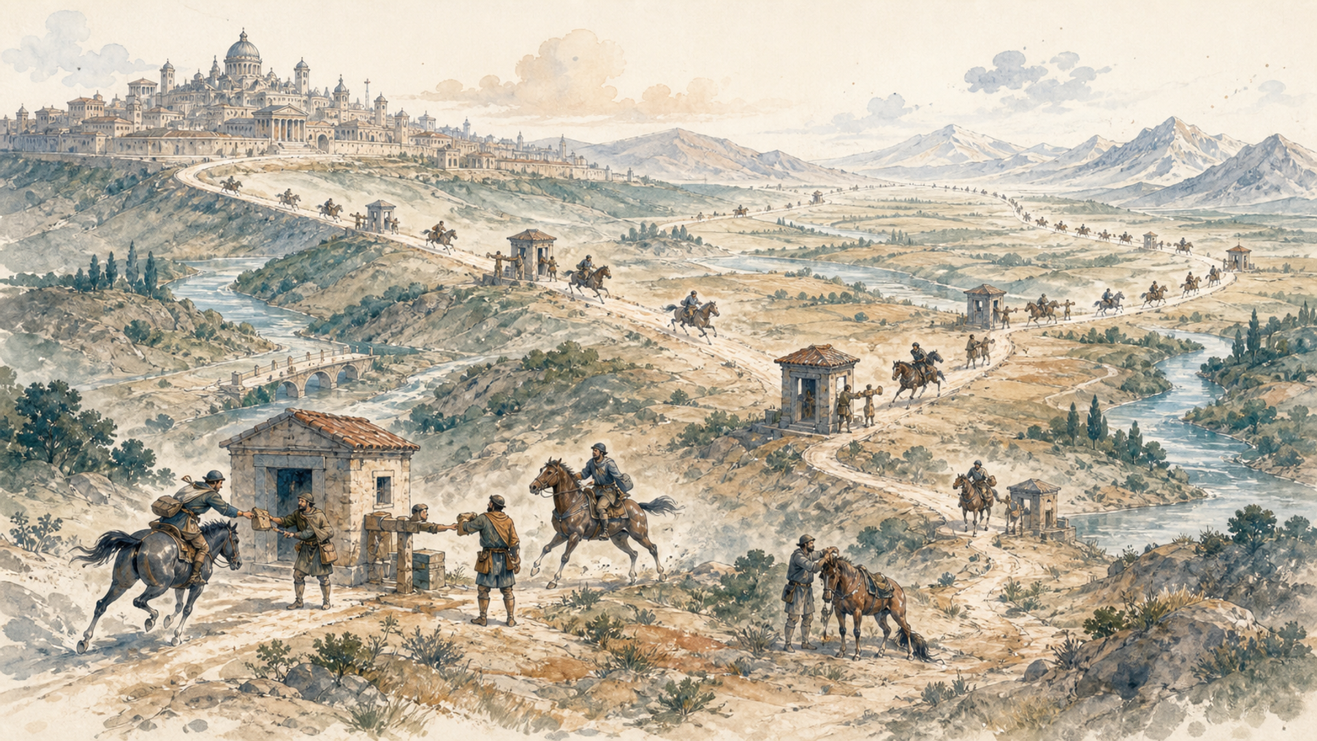
Imagine you are an emperor and a revolt breaks out two thousand kilometres from the capital. There is one problem: you do not know. It began this morning, but the messenger will ride for days, perhaps weeks. When the news finally arrives, you make a decision and send an order back. More weeks pass. Meanwhile, the local governor has negotiated, fought, lost or won without you.
Those of us accustomed to instant messages find it hard to grasp how profoundly information delay shaped politics for almost all of history. A government can now see satellite images of an event on another continent within minutes. To an ancient ruler, a distant province almost lived in the past.
The problem is not sending an order, but making it arrive in time
The Achaemenid Persian Empire developed roads and stations that let royal messengers travel swiftly by contemporary standards. The Royal Road, particularly associated with Darius I, joined Susa with western Anatolia through a system that impressed Greek authors. The exact journey time varies across sources and reconstructions. What matters is that the state deliberately invested in reducing communication time. A road did not merely move goods; it let the centre “feel” its periphery sooner.
Rome did something similar with an immense road network. Roman roads were neither identical nor exclusively military, but they aided armies, officials, merchants and the imperial post. An empire without roads is a shape on a map. With roads it begins to become a system.
Because a ruler cannot be everywhere, power must be delegated. This creates a universal political problem: a local representative needs enough authority to govern, but not enough to become independent. Persia had satraps, Rome provincial governors, and Chinese empires civil and military officials. Centres tried to supervise them through rotation, inspectors, taxation systems, family connections, rewards and punishments.
Distance creates opportunities. A governor controlling soldiers and revenue may discover that the capital’s orders arrive slowly and that nearby troops are more loyal to him than to a distant sovereign. Many civil wars and secessions begin when delegated power becomes autonomous. Geography determines not just the cost of invasion, but the cost of obedience.
The thirteenth-century Mongol Empire shows how organisation can change distance’s meaning. The Mongols used a network of postal stations known as the yam, where authorised messengers and officials found horses, shelter and supplies. An empire famous in popular imagination for mounted archers and devastating conquest also depended on something resembling a state logistics network. A courier did not ride one horse to exhaustion across thousands of kilometres; the system distributed effort and reduced waiting. An organised network mattered more than one exceptional rider.
Even the yam could not erase a continent. The Mongol Empire fragmented into khanates amid succession disputes, political rivalry, regional differences and distance. The network expanded what was possible. It did not make everything possible.
The sea can bring distant territories closer
Political distance does not always match geometric distance. Two cities a thousand kilometres apart by sea may be easier to connect than two separated by five hundred kilometres of mountain and poor roads. This helps explain empires that look strange on maps. A maritime power can hold scattered ports along distant coasts because ships connect them efficiently. A continental empire may struggle to reach an inland region formally joined to the rest of its territory.
The point is not that sea travel was always fast. Before steamships, voyages still depended on wind and season, and storms could erase schedules altogether. What maritime routes offered was the ability to move people, orders and heavy cargo through a known chain of ports. Regularity matters almost as much as speed. A government able to predict that ships leave each month can design rules around the delay; a government facing a road that vanishes into mud cannot. Effective distance is made from reliability, capacity and cost as well as kilometres.
The shape of a state matters. Square kilometres tell only part of the story. You must ask where mountains, rivers, ports, roads and populations are. Imagine two states of equal area. In one, most people live along navigable rivers, with roads and ports joining cities. In the other, people and resources are scattered behind mountains, deserts and forests with few routes. They look equal on paper; politically they are not. The first moves taxes, troops and information cheaply. The second pays more simply to remain connected.
This will matter when we examine the United States and Russia. America’s river systems and internal geography, combined with infrastructure built over time, encouraged integration of a vast market. Russia’s immense territorial depth is a resource, but connecting and defending it imposes huge costs. Size can be an asset and a tax at once.
Consider Britain governing India before telegraphy. A letter between London and Calcutta might take months. A colonial official could not wait for detailed instructions; the answer would arrive after the situation had changed. This gave officials wide discretion and forced the empire to create broad rules, hierarchies and an administrative culture capable of working without constant supervision.
In the nineteenth century, land telegraphs and undersea cables transformed that relationship. London received news and sent instructions incomparably faster. The telegraph was not merely a convenient messenger. It changed the timescale of government.
The modern state accelerates
Railways, telegraph, telephone, motor vehicles, aviation and the internet progressively reduced the time required to coordinate distant territory. Modern states can therefore enter daily life in ways ancient empires could scarcely imagine: taxing income directly, registering births, running national schools, transferring records in real time and coordinating police and services across a country.
These capacities do not come only from stronger political will. They rest on information infrastructure. The modern state “sees” more through censuses, databases, telecommunications and transport. Because it sees more, it can intervene more.
Centralisation is not always better. Rapid communication can deepen authoritarian control; it can also improve public services. Technology expands state capacity, while politics determines its use.
Distance has not disappeared. A decision crosses the planet in a second, but a container takes weeks; an army still moves vehicles and fuel; a road must still be physically built. Information has become vastly faster than material. This creates a modern oddity: we can know immediately that a component is missing on the other side of the world, but cannot make it arrive at the same speed. A military response can be ordered in seconds, but units must reach the place. Politics lives in the digital world; logistics remains material.
That mismatch can make authority look stronger than it is. A minister watches a crisis live, holds a video meeting and issues instructions before breakfast. Yet spare parts remain in another country, floodwater has destroyed the only bridge, or trained personnel require days to arrive. Instant knowledge creates an expectation of instant action that physical systems cannot always satisfy. The centre may become impatient with delays that are not administrative hesitation but geography asserting itself through matter.
Nor does fast communication guarantee understanding. A leader receiving a message within minutes may imagine that they can comprehend from London what an official sees in Delhi. The centre has overview and formal authority; the periphery has local knowledge. Decide everything centrally and you may ignore the ground. Delegate too much and you may lose control. Technology accelerates this conflict rather than abolishing it. Multinational firms and governments still wrestle with the problem of Persian satraps using infinitely faster tools.
The distant governor has a problem—and an advantage
Distance makes a governor more autonomous because the centre cannot supervise every choice. It also makes the governor vulnerable, because reinforcements may arrive too late. Empires solve this by working through local elites, marriages, client networks, bureaucracies and existing tax systems. Governing far away often means governing through somebody.
The image of an emperor issuing commands directly to millions is misleading. Between palace and village stand layers of officials, nobles, tax collectors, commanders, religious leaders and local notables who interpret, alter or ignore instructions. A decree can be perfect in the palace and almost irrelevant three months’ travel away.
Those intermediaries are not merely obstacles. They translate a distant order into local language and custom, know which harvest failed, which road is passable and which family can settle a dispute. Remove them and the centre may become blind; empower them and they may build authority of their own. Empires consequently rule unevenly. One province receives direct officials and garrisons, another keeps its elites in return for tribute, and a frontier community acknowledges the ruler only while doing so remains useful. Uniform colour on a historical map hides these different intensities of control.
For much of history, a frontier was not necessarily a line precise to the centimetre. It might be a zone of forts, allied groups, disputed lands or fading central authority. Modern maps train us to think every square metre belongs unambiguously to one state. Such precision requires surveying, cartography, coordinates, treaties, patrols and land records. Earlier power often weakened gradually with distance. We cannot project the modern state back onto the ancient world.
Faster communication creates its own paradox. The remote leader may intervene more often because more information arrives, even if that information remains incomplete. Local knowledge and central power still pull against one another. Information is not truth. A governor can exaggerate danger to obtain reinforcements; a tax collector conceal revenue; a local elite claim indispensability because the centre knows little of the territory.
No road solves trust completely. Empires devised inspectors, special envoys, rotation and parallel information channels. Sometimes these worked; sometimes they merely added bureaucracy. Contemporary governments receive data almost instantly and can still misread it. Technical latency has shrunk; political latency—the time needed to understand what is really happening—has never vanished.
A capital is a geographical choice too
Where should the centre of power sit? A coastal capital may trade easily and remain vulnerable to fleets; an inland capital may be protected and distant from commerce. States have moved capitals to alter territorial balance.
Peter the Great founded Saint Petersburg on the Baltic to orient Russia towards Europe and the sea. Brazil inaugurated Brasília in 1960 partly to drive development inland. Republican Turkey chose Ankara rather than Istanbul, tying the new state to an Anatolian centre distinct from the Ottoman imperial capital. A capital is not just the location of ministries. It signals which part of the territory a state regards as central.
Moving a capital cannot move the population, economy or roads overnight. A purpose-built centre may struggle to draw activity away from an older commercial metropolis; an inland capital may symbolically unite territory while officials and businesses continue looking towards the coast. Capitals are therefore both instruments and declarations. They attempt to redraw a country’s mental map, but their success still depends on the networks surrounding them.
The Inca Empire shows that distance was not solely a Eurasian problem. The Inca built and used an extensive road network across extremely difficult Andean environments, from coasts to mountain passes. They had neither draught horses nor an alphabetic script like Europe’s, yet coordinated an immense territory through roads, depots, officials and relay runners called chasquis. Knotted-cord systems known as quipu recorded numerical information and perhaps other data, though their interpretation remains an active field of research.
This example prevents us confusing one technology with the function it performs. There is no single way to build an informed state. The universal problem is knowing what resources you possess, where they are and how to deliver an order before it becomes useless.
Inca roads adapted to terrain rather than simply trying to erase it. Suspension bridges, steps and high-altitude paths enabled movement where some European solutions would have been poor choices. Geography posed a problem; society invented a response.
An order matters only if it arrives before the problem is over
Imagine governing a province thirty days from the capital. Revolt begins and you request instructions. Thirty days out and thirty days back means the answer arrives two months into the crisis. Meanwhile, you decide alone. Geographical distance has become political autonomy.
Ancient empires developed ingenious answers. The Achaemenids accelerated messengers through roads and stations; Herodotus famously admired Persian couriers. Roman roads served commerce, administration and military movement. Chinese dynasties developed postal and relay networks. The Mongol yam moved authorised messengers through vast country.
None eliminated time; all compressed it. That compression was politically revolutionary. Information taking ten days instead of thirty allows a response three times sooner. Reliable roads concentrate armies before revolt grows. Central power is not simply a number of soldiers, but an ability to perceive and react.
Verification travels along the same roads. A governor can send an impressive report quickly, but an inspector sent to check it must still reach the province, question people and return. Faster messages can increase the volume of information without ensuring its quality. A ruler may receive more figures and feel better informed while remaining dependent on whoever selected and categorised them. The problem is not only latency but trust.
Delegation makes empire possible and creates its risk. Satraps, Roman governors, Chinese officials and colonial viceroys all made local decisions in a distant authority’s name. The delegate may grow independent, steal, lie or build a personal following. States answered with cross-checks, inspectors, rotation, records, examinations and other devices. The success was uneven, but political architecture repeatedly responded to geography. A governor able to telephone the ruler every ten minutes needs different autonomy from one whose letter takes weeks.
Imperial China developed one of the most sophisticated large-scale bureaucratic traditions. Across centuries and with major dynastic variation, examinations on Confucian classics helped create an administrative elite with a shared culture, whose members could be posted far from home. It was not a modern meritocracy: family wealth, education and networks mattered immensely. Still, training officials in a common administrative language powerfully connected centre and periphery.
The Inca provide another warning against imagining one technological package for large states. Their road system, relay runners, organised labour, stores and mountain-adapted infrastructure moved information, people and resources without the horses and scripts familiar in Eurasia. The problem was universal; the answers were historical.
Their example also shows why infrastructure must be read inside its landscape. Andean paths used steps, high passes and suspension bridges rather than trying to reproduce roads suitable for wheeled carts. Storehouses placed supplies where officials and armies would need them; relay runners turned many short efforts into rapid long-distance communication. The Inca did not overcome the Andes by pretending they were a plain. They built a system around what mountain terrain permitted.
Then the telegraph arrived, and governors were no longer so alone
In the nineteenth century, the relationship between territory and command changed more radically than it had in millennia. For the first time, telegraph messages travelled far faster than people. A European government could receive news from distant regions and issue orders in a fraction of sailing-era time. Undersea cables gradually extended the network across continents.
Empires did not become easy to govern. Information remained incomplete or manipulated, decisions remained political, and armies still moved physically. But centres gained a new capacity to interfere at the periphery. Officials who had once decided independently because there was no alternative could receive instructions almost in real time by earlier standards.
Communication technology is geopolitical. Internet and satellites are the newest version of an old story: whenever the cost of sending information falls, political distance changes. Modern states coordinate administrations and armed forces on scales that would astonish a Roman emperor. Yet distance persists through digital infrastructure, time zones, transport and local knowledge.
“How far can you command?” has no answer in kilometres. It depends on how quickly you can know, decide, move and enforce. When one of those four capacities lags, power on a map may become far larger than power in reality.