Chapter 01 · Part 01
Why Do We Live Here?
Water, climate, food and the shape of the land before borders.
Before states and borders, there were rivers, plains, mountains, deserts and coastlines. Why did large human populations grow in some places rather than others, and how does geography create opportunities and costs without deciding our fate?
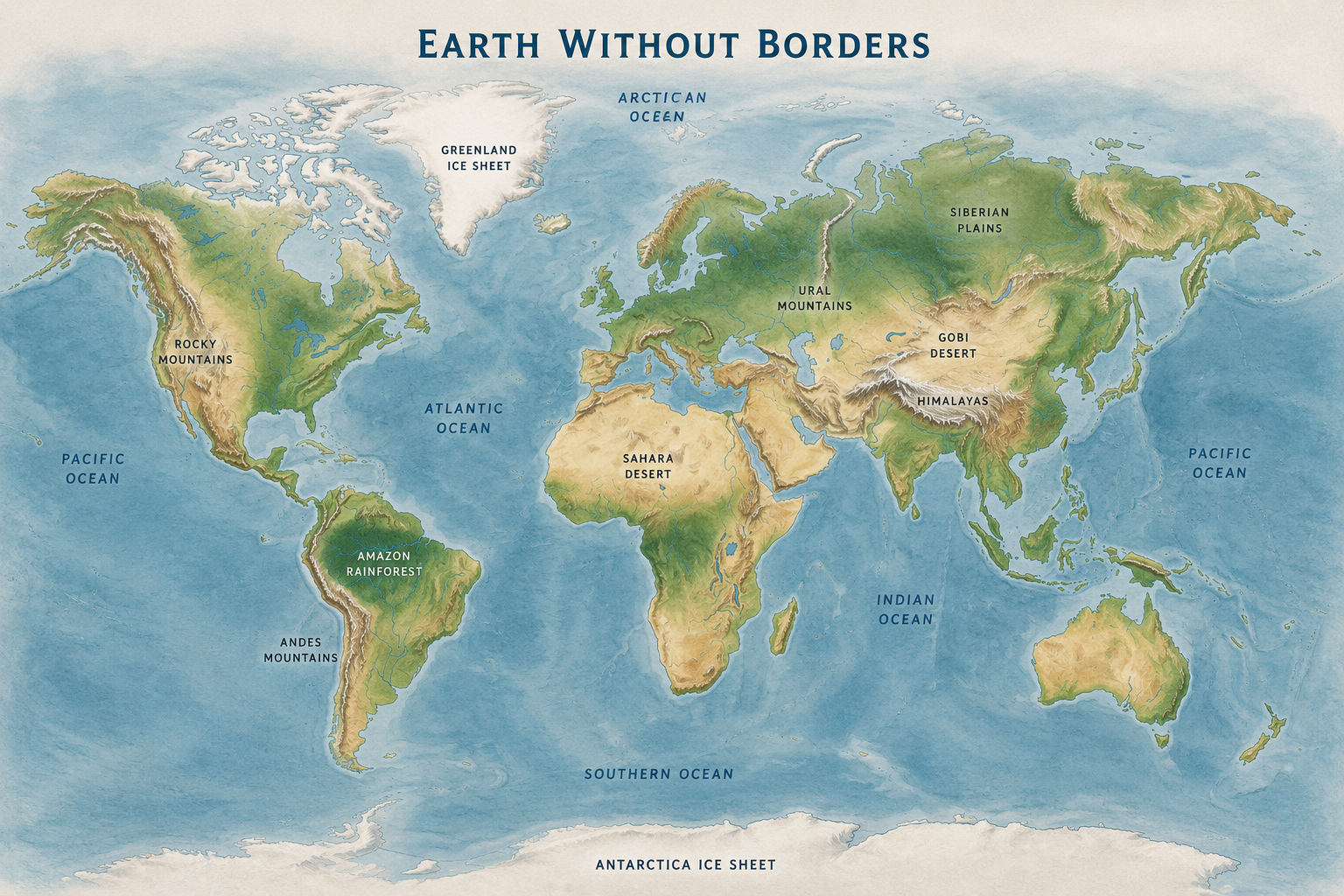
Imagine waking tomorrow morning, picking up your phone and opening a map. Italy’s coastline is still there. The Mediterranean still separates Europe from Africa, the Alps have not moved an inch, and the Nile continues to flow north. Yet something is deeply strange: every line has vanished. There is no border between Italy and France, no Russia shaded differently from China, no Brazil, Egypt or Ukraine. Nothing has happened to the Earth. Only the part drawn by us has disappeared.
Pause over that image and it delivers a small shock. We spend so much time looking at political maps that countries begin to seem like natural features of the planet, as though France and India had always existed in the same way as the Himalayas or the Atlantic Ocean. In reality, most lines we now take for granted are extremely young compared with the landscapes they cross. States, empires and frontiers appear, move, split and vanish. A mountain range or a great river basin remains long enough to shape the lives of generations who cannot know what political order will come after them.
That borderless map is the right place to begin. Before asking why the United States became so powerful, why Russia worries about particular frontiers, why China looks towards the sea, or why an artificial canal in Egypt can trouble businesses on the other side of the world, we need to ask an older and apparently simpler question: why did human beings settle in some places rather than others?
Before flags, there were water, food and distance
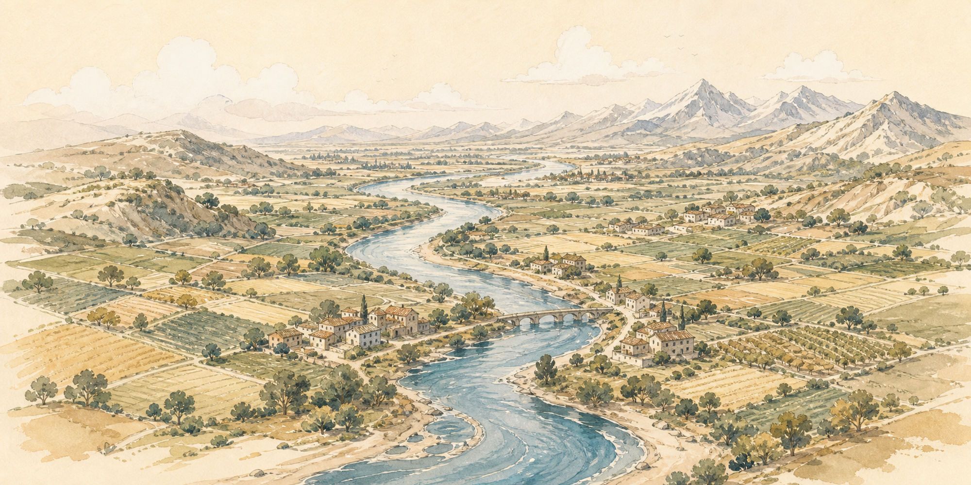
Suppose you had to choose a site for a new community without electricity, supermarkets, piped water, lorries, refrigeration or modern medicine. The landscape would immediately mean something different. A magnificent view from a mountaintop might lose its charm if every bucket of water had to be carried uphill by hand. A plain crossed by a river might suddenly look extraordinary: it offers water, cultivable soil, fish, a possible transport route and relatively easy ground on which to build.
The first great concentrations of people did not therefore appear at random points on the map. In several regions, complex societies grew around systems capable of supporting large populations: the Tigris and Euphrates in Mesopotamia, the Nile in Egypt, the Indus in South Asia, the Yellow River and other major waterways in China. That does not mean civilisation simply “began four times beside four rivers”, while the rest of the world stood empty. Farming communities and sophisticated societies developed independently in many other environments, from the Americas to New Guinea. The point is more modest and more useful: if many people are to live in the same territory, reasonably reliable access to water and food is an enormous advantage.
The Nile offers the most spectacular illustration. It runs through one of the driest regions on Earth and creates a long ribbon of fertile land through the desert. Seen from above, its valley looks almost like a green line painted across sand. Move far enough away from the river and the landscape changes sharply; the desert returns, and with it a very different range of possibilities for a community living without modern technology.
Even here, easy explanations are dangerous. A river is not automatically a gift. It may irrigate fields and flood them; serve as a commercial highway and an invasion route; connect distant cities and provoke disputes between people upstream and those who depend on the water below. The Yellow River, central to Chinese history, has been as dangerous as it has been valuable. Its floods and changes of course repeatedly devastated whole regions. Nature rarely hands over an advantage without conditions in the small print.
A good place can become a problem
Fertile plains are excellent for cultivation and movement. For precisely that reason, they can also be difficult to defend. A mountain slows a merchant, but it slows an army too. A broad plain makes it easier to carry grain between cities, but gives fewer natural obstacles to people arriving with less friendly intentions. We will meet this double character of landscape again and again: what enriches a place may expose it, while what protects it may isolate it.
Think of a valley enclosed by mountains. To its inhabitants, the peaks may resemble a colossal wall. They hinder invasion, allow local languages and traditions to survive longer, and physically separate one community from another. Yet the same barrier makes roads expensive, trade difficult and contact with distant regions uncertain. There is no single “best geography”. There are features that become advantages or disadvantages according to the historical period, the available technology and what a society is trying to achieve.
Coasts share this ambiguity. For thousands of years the sea could appear to be the edge of the known world, a dangerous expanse separating distant peoples. As navigation improved, the same water became a road. Moving a heavy cargo by ship can be vastly more efficient than dragging it over land. A useful coastline, a natural harbour or a narrow strait can then become a strategic resource. The geography has not changed. Human beings have changed what it means.
This is one of the ideas that will follow us throughout the book: technology does not abolish geography; it rewrites it. A mountain pass that channelled travellers and goods for centuries may lose importance when a tunnel opens. A desert that once seemed to offer little may become crucial when oil is discovered beneath it, or when abundant sun and open land acquire value for energy production. A small island that appears peripheral may become essential because it sits on a commercial route or concentrates an industry on which economies thousands of miles away depend.
Geography also has a deeper relationship with power. If a territory produces enough food for a large population, it changes more than the number of people able to live there. It changes what those people can do. Imagine a village in which nearly everyone spends most of the day obtaining enough to eat. There is little room to maintain large groups of soldiers, administrators, craftspeople or builders who do not produce their own food. If farming creates a surplus that can be stored, part of the community can specialise. Someone makes tools; someone trades; someone organises collective works; someone fights; someone records debts and harvests. A state does not automatically spring into existence, but the material conditions for a far more complex society begin to appear.
It is easy to underestimate the relationship between territory, food, population and political organisation today, when a city may receive its meals from thousands of miles away. For most of human history the connection was more visible. A vast city could not order everything it needed from another continent and expect delivery tomorrow. It required a countryside capable of feeding it, systems for transporting and preserving food, and some form of authority able to organise at least part of that flow.
This produces a curious paradox. The more successfully a place concentrates people and wealth, the more interesting it becomes to outsiders. Fertile fields, prosperous cities, ports and trading routes attract merchants, but they also attract conquerors. Some of history’s most contested territories mattered not despite being valuable, but because they were valuable.
When nature demands organisation
Living near water is not simply a matter of turning up and enjoying it. Rivers must be crossed, embankments maintained, canals dug, reserves stored and crops protected against bad seasons. In many ancient societies, organising large collective works became an important part of political life.
It would be a mistake, however, to leap from this observation to the claim that “irrigation created despots”, or that every great river inevitably produced the same kind of state. Societies in apparently similar environments followed very different paths. Geography can present a recurring problem—managing water, for instance—but it does not prescribe a single solution. Communities may respond through central authority, local institutions, shared customs, different systems of ownership or a mixture of these. Environmental conditions matter, but so do ideas, power relations, technologies, institutions and an element that disappears from histories that are too tidy: chance.
Geopolitical explanations have an irresistible temptation. You look at a map, spot a mountain or river, and everything suddenly seems obvious: “That is why this country did that.” The explanation is satisfying because it turns a complicated history into a simple rule. That is exactly when you should become suspicious. Geography is a powerful lens, but a lens is not the whole landscape.
Human beings cheat constantly
If geography really were destiny, the Netherlands would face a serious problem. Much of the country is extremely low and some areas lie below sea level. For centuries, however, its inhabitants have built dikes, canals, drainage systems and hydraulic works that radically altered the relationship between land and water. They did not abolish the sea. They invested vast amounts of organisation, knowledge and resources in reducing a geographic constraint.
Human beings do this constantly. We cut canals through isthmuses, bore tunnels through mountains, divert rivers, build bridges, drain wetlands, construct harbours where the coast was inconvenient and carry water to cities that could not otherwise sustain millions of people. The game changes each time, but one detail should not be missed: changing geography is expensive. It requires energy, capital, technology, institutions and time. Even when we “overcome” a natural obstacle, nature still sends the bill.
Take a mountain. To an ancient traveller it might mean days of labour, a compulsory route or a seasonal obstacle almost impossible to cross. To us it may mean a motorway through a tunnel, but that tunnel did not appear by magic. It is made from machinery, steel, explosives, engineering, money and continuous maintenance. Technology creates new choices; it does not make every choice equally easy.
This relationship between space and cost makes geography politically important. A state does not truly control a territory merely because it colours it on a map. It must be able to reach, administer, defend and connect that territory, and move people and resources there when necessary. We will encounter empires that looked immense on paper but waited months for an answer from the frontier, and modern states capable of coordinating enormous territories almost in real time. Distance has not disappeared. We have learned to pay its cost in new ways.
The map begins to speak
Return in your mind to the borderless map with which we began. It is no longer as empty as it seemed. Certain places already draw the eye: broad plains where cultivation and movement are easier, rivers that feed and connect communities, mountains that divide regions, coasts that may one day open towards the wider world, deserts that make crossing great distances costly. You do not yet know where empires will arise, which religions will spread, what languages will survive or which states will draw borders across this landscape. That is the point. Geography cannot predict history as astronomy predicts a planet’s orbit. It can reveal the table on which choices will be made and help explain why some moves cost more than others.
Soon we will add roads, cities, armies, ports, trading routes, railways, pipelines, cables and satellites. Every new layer will alter what came before without completely erasing it. That is how the world becomes woven: terrain influences human choices; human choices reshape terrain; technologies change the value of apparently marginal places; wars and trade leave borders and infrastructure that constrain the people who follow.
Before moving on, however, we need to guard against turning a tendency into a formula: water plus plains plus grain equals civilisation. It would be convenient, and wrong. Great river valleys supported dense populations and early states in several parts of the world, but they were not the only environment in which people created complex societies. In the Americas, major cities and sophisticated political systems emerged under conditions very different from Mesopotamia. Andean societies dealt with altitude, steep slopes, sharply varying climates and, in places, an exceptionally dry coast. In the highlands of Mexico, enormous cities rose in lake basins requiring their own agricultural solutions. Agriculture developed independently in the tropical highlands of New Guinea. Geography supplies problems and possibilities, not a blueprint. Different societies can answer the same problem differently, while distant societies may reach similar results from very different environments.
Even “fertile land” is more complicated than it sounds. Fertility is not simply a natural property waiting to be collected. The alluvial plain of southern Mesopotamia, home to some of the earliest large cities, required water management. Irrigation could increase production enormously, but demanded work, maintenance and coordination, and over time could contribute to soil salinisation. The Nile behaved differently, with seasonal floods central to Egyptian agriculture for millennia, but the relationship between river and society was not automatic there either. Even when nature seems generous, people must build the infrastructure, rules and habits that turn an opportunity into a dependable food supply.
That detail already takes us close to politics. If a dam, canal or system of embankments requires the coordinated labour of thousands, who decides when people work? Who distributes the water, settles disputes and stores the surplus? Scholars once tried to explain the rise of states directly through the need to organise large irrigation systems. History is too varied for such a straight line: some irrigation systems have been managed locally, while powerful states have arisen in very different environments. Yet when an environment makes cooperation valuable, it creates a space in which institutions and power can grow. It does not dictate which institutions will emerge, but makes some forms of coordination especially useful.
A place that suits you may also suit your microbes
There is a less romantic side to places where humanity gathers. Wherever many people live close together, where humans and domestic animals share space, where water and waste require management, and where merchants arrive from afar, disease finds new opportunities. Cities have been engines of innovation, commerce and culture, but for long periods they also suffered such high mortality that many needed a constant flow of migrants from the countryside merely to maintain their populations. Sewers, safe drinking water, vaccination, germ theory and antibiotics eventually transformed this relationship. For now, notice the double effect: a concentration of people is both a political and economic resource and a biological vulnerability.
Climate also has consequences that change over time. A tropical region may be extraordinarily productive in biological terms while harbouring diseases that made settlement harder for populations lacking immunity or effective medicine. Cold regions may have shorter growing seasons but fewer vectors for certain diseases. None of these factors produces wealth or poverty by itself. They matter when interwoven with available crops, technology, institutions, exchange and medical knowledge. Once again, a geographic correlation is not a verdict.
Location changes value when the world changes
If we could view the same physical map in different eras, its mountains, rivers and coasts would look almost identical, but their political value would continually change. A coal-rich region might be marginal before coal became the fuel of industrialisation, then turn into the heart of a manufacturing system. An oilfield meant something different before the internal-combustion engine, aviation and modern fleets. Today, deposits of lithium, nickel, copper and rare-earth elements acquire significance because electronics and the energy transition require materials earlier societies valued differently.
Even a location can change meaning without moving. When the Mediterranean lay at the heart of major commercial networks, cities such as Venice and Alexandria occupied exceptional positions. As oceanic routes opened and Atlantic trade expanded, Europe’s economic centre of gravity gradually shifted. The opening of the Suez Canal in 1869 gave the Mediterranean another role as a corridor between Europe and Asia. The Earth remains, while technology and economics redraw the map of opportunity.
This is the most important correction to the idea that “geography decides”. If the meaning of the same place varies so much over time, there can be no mechanical relationship between terrain and destiny. There are relatively stable constraints and changing values assigned to them by people. The sea is a barrier until you possess reliable ships. A mountain creates isolation until you build a tunnel. A remote coast becomes strategic when a trade route passes nearby. A desert may conceal energy, minerals or room for infrastructure. History is, among other things, the story of how we learn to read and rewrite the meaning of places.
Now we can test this idea in the most brutal way possible. If a mountain can make a road more expensive, can it stop an army? If a river can feed a city, can it protect one? And when thousands of armed people must cross a continent, how much does landscape matter beside courage, weapons and the skill of a commander?